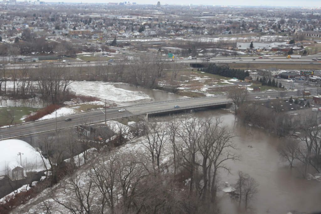
Triangle Neighborhood- images Abbott Road and Triangle Street (SouthPark)
The Triangle neighborhood is an urban residential area located in the Thirteenth Ward on the south side of the City of Buffalo, New York. South Buffalo was formerly a thriving industrial area of Buffalo, a city that once ranked as the eighth largest in the country. Due to its location at the eastern most point of navigation of four of the Great Lakes, Buffalo grew in the nineteenth century from a meager village to one of the most important manufacturing and transportation centers in the United States. After the War of 1812, when the British troops burned the original town laid out in 1804 by Joseph Ellicott, local citizens quickly rebuilt with a vision of empire.
Seeing the lake as the key to the city’s future, early town founders concentrated on creating a proper lake front harbor. The opening of the Erie Canal in 1825 inaugurated the city’s prosperity, making it the port through which goods and people traveled eastward from the developing West and westward from the seaboard cities of the East. The storage and transshipment of grain became a major industry, especially after 1842 when Joseph Dart erected the first grain elevator near the mouth of the Buffalo Creek. By the end of the century, giant sheds for the storage of Mid-Western grain lined the river way. Their early-twentieth-century concrete descendants gave Buffalo the largest grain storage capacity of any city in the world.2 Establishment of a railroad infrastructure in the 1840s consolidated Buffalo’s position as a transportation hub. Heavy industry began to develop before the middle of the nineteenth century and grew rapidly after the Civil War. With ore from Michigan and the upper Mid-West and coal from Pennsylvania, Buffalo’s lakefront became a booming national center of iron and steel making. Other significant manufactures that flourished until the 1950s included those that made rubber, automobiles, chemicals, dyes, and paint. In the
1940s, the city boasted 1,400 plants and a work force of 200,000. Changing inland patterns of transportation and the effects of globalization on American industry have conspired since the 1960s to reduce Buffalo’s importance as a city. Despite these hardships, significant architecture and landscape architecture remains from the 150-year period of growth. The Triangle neighborhood, especially, is home to many buildings that reflect the residential expansion of the city southward in the late nineteenth and early twentieth centuries.
This buildout of the urban core, which was common to many American cities at the time, was here influenced by the construction of new parks and parkways designed by the Frederick Law Olmsted and his son, John C. Olmsted.
Early History to 1850
The Arrival of the Seneca from the Genesee Valley and the Establishment of
the Buffalo Creek Indian Reservation: 1779-1799
Evidence of human habitation in the area stretches back to Neolithic times and was linked to the stream that present-day residents know as the Buffalo River, and early settlers called the Buffalo Creek. The aboriginal name for the creek was Do-syo-wa, place of the basswood trees. French fur traders established the first European settlement in the area in 1758. They located an outpost along the banks of the creek, where, apparently, beaver were plentiful. With the French and Indian War, however, the region came under British control. English cartographers
were the first to record the name Buffalo Creek.
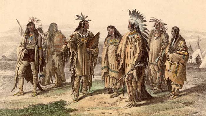
images Seneca American Indians
The French and the English hardly touched the forests and sand dunes that made up the pristine shoreline of Lake Erie south of the later city of Buffalo. The Seneca held the first significant human settlement of the area. During the American Revolution, the Seneca, together Intensive Level Historic Resources Survey City of Buffalo: Triangle Neighborhood with the Mohawks, Onondaga and Cayuga, were the target of General John Sullivan’s 1779 Genesee Valley campaign. Panic–stricken by Sullivan’s brutal tactics, they sought the protection of their British allies who maintained control of the Niagara Frontier. In the late summer of 1779, the immigrants arrived at Fort Niagara where the British commander, Col. Guy Johnson, gave them refuge. The refugees spent the winter of 1779-1780 camped near the fort and saw many of their number perish because of the exceptionally harsh weather. In the spring, the remaining
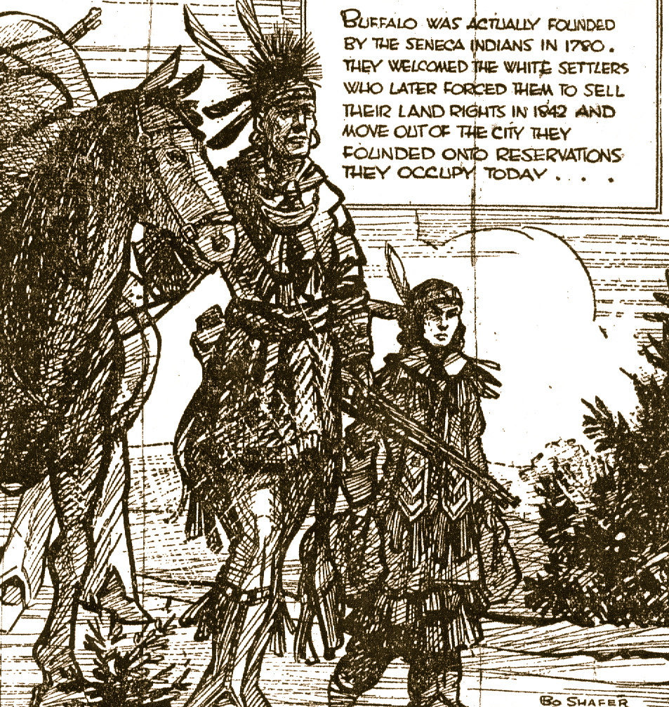
Senecas, under the leadership of “Old King” (Siangarochti) and with British assistance, took up residence in the woodlands south of Buffalo Creek and on the flat bottomland east of what came to be known as Martin’s Corner (the juncture of the present Abbott Road and Southside Parkway). When Col. Johnson visited the fledging pioneer settlement in the summer of 1780, he reported that it was “increasing fast” and that 1,200 people had already settled there.3 Women had cleared land and planted corn and men had built log huts and resumed hunting. The community lived peacefully and unmolested by American troops during the remainder of the Revolution. In negotiations between the victorious United States and the Six Nations at Fort Stanwix in 1784, Old King represented the Senecas along with Cornplanter and Red Jacket, two other residents of the Lake Erie settlement.
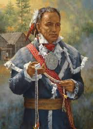
Red Jacket
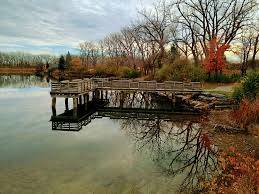
The Treaty of Fort Stanwix extinguished Indian claims to all the future Mid-Western lands and secured the vital portage route around Niagara Falls free of Indian control. Ten years later the United States established the Buffalo Creek Indian Reservation, land that included the present Triangle neighborhood. But Seneca ownership of extensive property in Western New York was doomed to be temporary. At Geneseo in 1797, the Seneca’s formally relinquished claim to large areas of their land. Over the objections of the valiant Red Jacket, the council agreed to a treaty that cleared the way for the acquisition of much of their reservation in the following year by the Holland Land Company. However, the Senecas retained over three hundred square miles of land for themselves, notably the 130- square-mile Buffalo Creek Reservation. This was “a liberal provision for the comparatively small remnant of the Six Nations then remaining in the State,” thought the early historian of Buffalo, William Ketchum. The fauna, if not the flora, that one would have found in the Triangle neighborhood during those halcyon days is undoubtedly present at the nearby Tifft Farm Nature Preserve, a wildlife refuge reclaimed from abandoned industrial land in 1976. Surely, predecessors to the muskrat, beaver, ducks, wild birds, and other species that frequent Tifft Farm must have made their home on the earlier landscape of the Triangle neighborhood.
Joseph Ellicott and the Holland Land Company: 1799-1838
The acquisition of former Indian lands by the Holland Land Company was to mark the beginning of the Euro-American settlement period in Western New York. This wealthy corporation of Dutch land speculators was responsible for the establishment of Buffalo, a place that the company called New Amsterdam, and for the settlement of the region. In 1799, the directors employed Joseph Ellicott to survey the future site of the city of Buffalo; five years later, Ellicott mapped streets on the model of Pierre L’Enfant’s Washington and began the division the land into building lots.
Joseph Ellicott (image) laid out a city sited on the southern shore of Lake Erie, near the beginning of the Niagara River, a 25-mile-long straight that connects Lake Erie, the smallest of the five Great Lakes, with Lake Ontario. Ellicott chose a location where the Buffalo River flows into Lake Erie. He focussed the center of town around Niagara Square. From this point, important streets radiated east and north toward what became the inland sections of the city. About a mile to the south of Niagara Square, along the banks of the Buffalo River, the city’s vast harbor and industrial sector emerged. The Triangle neighborhood occupies part of these flat lands that Intensive Level Historic Resources Survey City of Buffalo: Triangle Neighborhood border the meandering Buffalo River, about a mile east of Lake Erie. In the early nineteenth century, access to the center of town from this area was by way of Abbott’s Corners Plank Road (the present Abbott Road,
which was surveyed in 1833-1834 and followed an old Indian trail and Elk Street. In Ellicott’s day, however, the entire southeast corner of the city (the area that included the future Triangle neighborhood) was part of the Buffalo Creek Reservation. The City of Buffalo annexed the area that includes the Triangle neighborhood in 1854. As the city grew, development pressure increased on the native residents of the Buffalo Creek Reservation to give up their land. In light of later developments, their removal seemed inevitable. In the 1820s, under Red Jacket’s leadership, the tribe had fought off an unscrupulous attempt by the Ogden Land Company to dispossess them of their Western New York lands. It took the intervention of President John Quincy Adams to negate an unfair treaty that had actually been negotiated between the Indians and the land company.
The Demise of the Buffalo Creek Reservation: 1838-1850
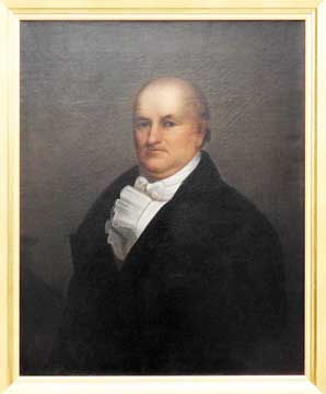
President Adams’ principled decision only delayed the certain fate of the reservation. As Buffalo historian Mark Goldman has observed, in the age of Andrew Jackson the national attitude toward native Americans was to see them removed from the path of expanding Euro-American settlement. Western New York was no exception. “Under the pressure of rapidly growing population in the city of Buffalo,” notes Goldman,” there was little sympathy for the few thousand Senecas still living along the Niagara Frontier. In 1838, the federal government submitted a draft treaty that required the some 2,000 Seneca to sell their land and be relocated to Kansas. In the summer and fall of 1838, the Indians (now without Red Jacket, who had died in 1832) met in council at Buffalo with government agents to discuss the proposal. Present at the council, as a government representative was Henry Dearborn. His diary records a lively account of the proceedings and provides a rare glimpse of the keen interest local land speculators took in the proceedings. Dearborn expressed sympathy for the Seneca and felt that the government’s offer of compensation and transportation to the West was very generous. He questioned the motives of those who counseled the Indians to resist. “Mr. Heacock, a wealthy man but a great black- guard,” wrote Dearborn, “had the effrontery to harangue the Indians and spectators, yesterday in the Council House. . . . This infamous man, the owner of a canal which runs through the Indians’ lands, is fearful, if the treaty is confirmed he will be obliged to pay a just price for the use of it to the pre-emptioners instead of the paltry sum of $30 per year to the Indians.” On the other hand, Dearborn recorded that Heacock, who “had traded with the Indians for many years,” owned a large amount of property adjoining the reservation that would greatly increase in value if reservation land were sold to Euro-Americans.

Reuben Heacock, (image) a banker and a prominent figure in the fledging city, had been influential in the establishment of the nearby Hydraulics. This glorified mill race (probably the canal that Dearborn spoke of in his diary) utilized water from the Buffalo Creek to power the first manufacturing district in the city. Whether Heacock was a scoundrel or a friend to the Senecas, his association with the Triangle neighborhood is remembered in Heacock Park, 4-acre plot of ground at the juncture of the present Abbott Road, Southside Parkway, and McKinley Parkway.
In January 1854, Heacock and his wife deeded this property to the city, making it one of Buffalo’s earliest pubic green spaces. The reason why Heacock or his heirs designated this parcel to be preserved from development has been lost, but Heacock would have purchased the ground, along with other property the family owned in the Triangle neighborhood, after the treaty with the Senecas was ratified by the U. S. Senate in 1842. At that time, the Buffalo Creek Reservation lands were sold to the Ogden Land Company, but the Senecas retained the Allegheny and Cattaraugus reservations. Quoting Alexis de Touqueville on the rapaciousness of Intensive Level Historic Resources Survey City of Buffalo: Triangle Neighborhood the “European race” in face of the native American, historian Mark Goldman observes that “by1850 Red Jacket’s Buffalo Creek reservation was abandoned and cleared for development.”
THE TRIANGLE NEIGHBORHOOD IN THE LATE NINETEENTH AND
EARLY TWENTIETH CENTURIES
The Construction of Parks, Parkways and Streets in South
Buffalo: 1850-1910
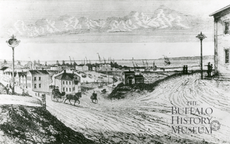
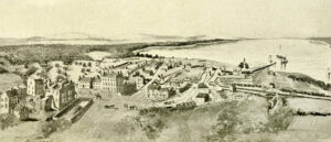
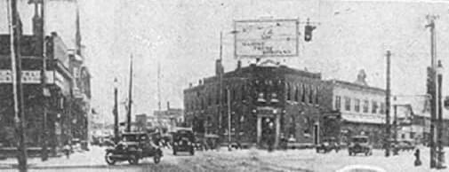
View of the Buffalo Harbor from The Terrace, 1825 In its earliest days, two important regional north-south thoroughfares, Abbott’s Corners Plank Road (present Abbott Road) and White’s Corners Plank Road (present South Park Avenue) crossed the Triangle neighborhood. Where they met, an intersection formerly known as Martin’s Corners (and the locale of Heacock Park), was three-and-one- half miles from Niagara Square. Traffic from the south reached the center of town by way of Abbott’s Corners Plank Road, which eventually joined Elk Street on the way into town. White’s Corners Plank Road continued northward after its intersection with Abbott’s Corners Plank Road toCazenovia Creek and ended a short distance beyond that at the Aurora Plank Road. In 1855, the year after the city limits were expanded to include former reservation land (and the Triangle
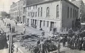
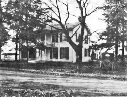
neighborhood), Triangle Street (image) was constructed to link White’s Corners Plank Road with Abbott’s Corners Plank Road. Traffic to and from the city might now avoid Martin’s Corners. The near right-angle triangle formed by the three streets gave the area the name by which it is still known today, despite the fact that Triangle Street became South Park Avenue in 1939. For much of the last half of the nineteenth century, the area had few other streets. An 1887 city map shows only Tifft Street (declared a public highway in 185012), near the southern boundary of the district, Hopkins Street (opened in 185513), the western boundary of the neighborhood, and Trowbridge Street (opened in 189114), connecting Hopkins and Triangle streets, as complete thoroughfares in addition to the two plank roads and Triangle Street. Clearly, the area had remained rural since the demise of the Buffalo Creek Reservation.
In April 1887, the citizens of the Thirteenth Ward successfully petitioned the Common Council to extend the park system that Fredrick Law Olmsted (image above) and Calvert Vaux had planned in 1870 for the northern part of the city southward through the ward to the shore of Lake Erie. To design these new roads and parks, the city once again sought the services of Frederick Law Olmsted and his firm in Brookline, Massachusetts. In 1888, Olmsted and his son John C. Olmsted reported to the city that the chief hindrances to the development of the South Buffalo area were poor drainage and difficult access. Spring rains invariably brought flooding of the Buffalo and Cazenovia Creeks and the proliferation of rail lines made travel to the area from the north nearly impossible. “The value of real estate in the southern outskirts of the city is much less than in the northern outskirts,” observed the Olmsteds. “The degree in which it is so, is largely due to the fact that between these southern outskirts and the main body of the city,” they observed, “there is a district so crossed by railroads, creeks, canals and swamps, that communication across it by ordinary street conveyances can only be had in a way which, to those who have not become habituated to it, is frightfully perilous, besides being extremely tedious and disagreeable. At times, even such communication as has been characterized, is impossible because of floods.” As part of their general scheme for improving and developing the area, they recommended the creation of a large recreational and scenic park on the lakeshore near Stony Point and a smaller pleasure ground inland to the east.
Intensive Level Historic Resources Survey City of Buffalo: Triangle Neighborhood
South Park Ave
Abbott Rd
Triangle St
(South Park Ave)
Late nineteenth century road network of the Triangle Neighborhood.
Note the presence of plank roads along the major arteries.
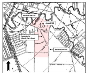
(Map of City of Buffalo, Buffalo: Matthews & Northrup Co., 1887)
The Olmsteds also proposed that parkways (wide, boulevards lined with multiple rows of trees) be laid out to link the new southside parks to parkways and streets in the northern part of the city and to one another. They foresaw the day when new parkways would structure the growth of residential neighborhoods in South Buffalo, the way they had decades earlier in North Buffalo. The key that would unlock the areas potential, they thought, would be the creation of a way for traffic to cross easily the network of railroad lines that formed a barrier between the northern and southern parts of town. “If a single road could be made which by sufficient causeways and bridges on almost any line that would provide good, safe passage across this intermediate district, all property over a large space to the southward of it would be greatly benefited,” they stated. Specifically, they recommended that a direct approach from the central parts of town to the southeast by means of a viaduct over the intervening railroad tracks. The route would then lead southward through what is now the Triangle neighborhood to the new scenic park on the southern border of the city. “As to the plan and courses of this thoroughfare,” the Olmsteds advised that “it be given the general character of Fillmore Avenue; that its breadth be nowhere less than ninety nor more than a hundred and twenty feet; that its centre line shall follow the centre lines of Abbott’s Corners Road, Triangle Street.
White’s Corners Road (the name was changed in 1893 to the present South Park Avenue and Ridge Intensive Level Historic Resources Survey City of Buffalo: Triangle Neighborhood Road to the entrance to the park at Hamburg turnpike . . .”In addition, they recommended that Abbey Street be upgraded to a parkway leading to the eastern entrance to the lakeside park and that a small parkway be created leading to the proposed park east of the area. In light of what they saw taking place in the area that would include the future Triangle neighborhood, the Olmsteds felt compelled to urge the city to act soon to make improvements in South Buffalo in order to avoid disaster. “On one of its margins Buffalo is beginning to be built out upon a flat region with no constant drainage outlets,” they warned, adding that the area is often water-soaked to the surface; more or less swampy; and at times completely overflowed. The tendency to build in this direction has greatly increased of late years. It will be much accelerated by the intended improvements to be made by the city in co- operation with the railroads and by development of the grand commercial undertaking, now far advanced, of the Lehigh Valley Railroad Company [this land is now the Tifft Farm Nature Preserve].
Foundries, factories, storehouses, coal docks, lumber yards, shipyards, and the like will be established, and not far from them, nor long afterwards, there will be dwellings for those employed in them and shops for supply their domestic wants. As long as such progress of building continues without the adoption of comprehensive, systematic, scientific measures for providing drainage and sewerage outlets; for determining the courses and grades of streets; and for the regulation of building upon and between them with reference to drainage and sewage, another great evil will be growing upon the city . . . It will be brought to an end . . . when the whole city is in mourning and its business suspended because of disease of which this region will have been the propagating ground. Eventually Buffalo’s park commissioners rejected the Olmsted’ vision of a 350-acre waterfront park and, instead, had them design two new inland parks, 155-acre South Park (1894) and (further eastward) 76-acre Cazenovia Park (1896).
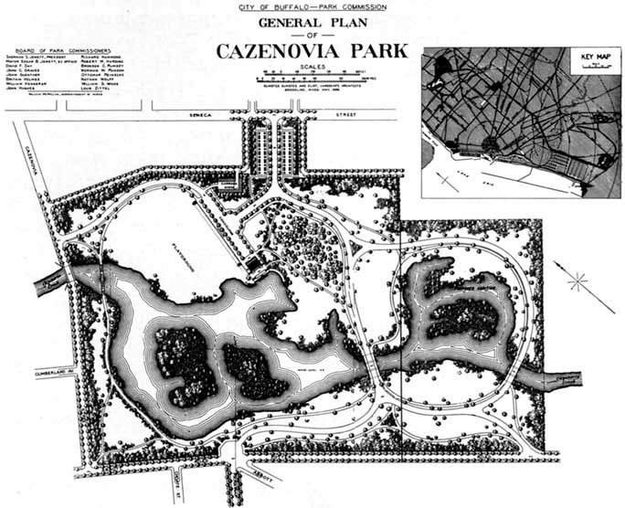
In 1894, the year before Frederick Law Olmsted’s retirement, the firm made plans for these parks and two new parkways that would join them to each other and to the northern part of town. Beginning at Heacock Park, McKinley Parkway (former South Side Parkway) ran southwest to McClellan Circle (former Woodside Circle) where it met Red Jacket Parkway coming from Cazenovia Park to the northeast. From McClellan Circle, McKinley Parkway curved in a southeasterly direction to South Park. Olmsted’s plan for joining McKinley Parkway to Fillmore Avenue by means of a grand viaduct over the Buffalo River and adjacent railroad tracks never came to be. The southern parkway system effectively terminated at Heacock Park, although in the 1930s the city laid out a northward extension of McKinley Parkway within the Triangle neighborhood as far as Bailey Avenue. And even though the Olmsted parks and parkways are outside of the Triangle neighborhood, they were a catalyst for its growth as a residential neighborhood. “Olmsted evolved proposals for a series of public spaces in Buffalo,” writes historian Charles Beveridge, the leading Olmsted scholar, “that were closely tied to the expansion of the city. The imaginative creation of landscape designs that met both the recreational needs and planning necessities is at the heart of the legacy that he and his associates left for future generations.”
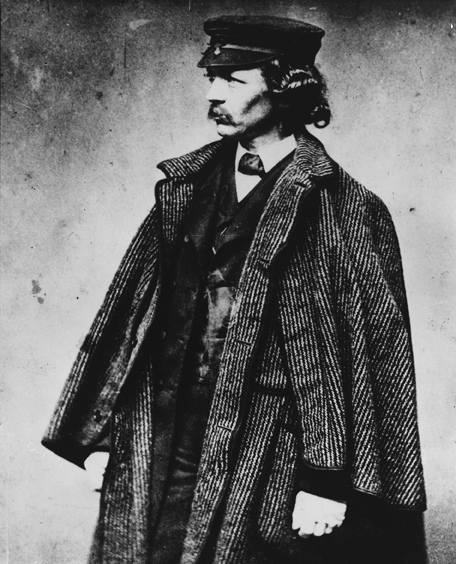
Frederick Law Olmsted
The Olmsteds cautioned that the new parkways should be planned in conjunction with other new streets in the area. No records, however, exist to suggest that the firm made plans for new streets in the Triangle neighborhood, as it did in Depew and North Buffalo at this time. Most of the streets that are found in the district today were opened between 1891 and 1895 . Bailey Avenue was extended southward across the Buffalo River to Abbott Road in 1891. Durant Street was apparently created in the 1920s to unite two unmatched ranges of parallel streets platted between Triangle Street and Hopkins Street. In the 1930s local residents Intensive Level Historic Resources Survey City of Buffalo: Triangle Neighborhood agitated for a through route from the end of Main Street in downtown Buffalo to the southern city line at Ridge Road. In 1939, the city created the new thoroughfare of South Park Avenue. From the end of Main Street, it usurped Abbott Road as far as Triangle Street, all of Triangle Street, and White’s Corners Road. The portion of White’s Corners Road between South Park Avenue and Abbott Road then became Southside Parkway. (This name had originally been applied to the present McKinley Parkway.)
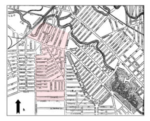
Triangle Neighborhood in 1899
Note South Side Parkway (Current McKinley Parkway) and Cazenovia Park. Intensive Level Historic Resources Survey City of Buffalo: Triangle Neighborhood . Another important street construction project that affected the development of the Triangle neighborhood took place in the 1920s when the city undertook to dredged and straightened the Buffalo River and Cazenovia Creek.
(These two waterways define the northern boundary of the Triangle neighborhood.) From time immemorial these two lazy bodies of water had caused widespread annual flooding. “These two streams wander about the district southeast of the Lackawanna Railroad as though they didn’t have any particular place to go and didn’t care when they got there,” observed a Buffalo resident in the mid 1920s. “They have no purpose in life but to furnish raw material for mud pies,” he quipped.27 In order to correct this situation and make the area suitable for buildings, the city dug a new channel for the Buffalo River which ever after abandoned the bend that came perilously close to South Park Avenue. The new, straight channel and a similar trench that diverted the waters of Cazenovia Creek from its former meandering riverbed now define the northern boundary of the Triangle neighborhood. In conjunction with this work, Bailey Avenue was extended from the bridge over Cazenovia Creek southwest to Abbott Road (the present South Park Avenue) at Triangle Street. From here traffic could easily reach Hopkins Street, which the city paved and extended to South Park. A new branch of McKinley Parkway was also created running southeasterly from the Bailey Avenue bridge over Cazenovia Creek to the intersection of Abbott Road and Heacock Park.
At the same time, Tifft Street was extended on the east and the west so that it became a major artery for commercial traffic passing through South Buffalo. These changes were seen as both opening up new areas to development28 and as bringing new tourist dollars to area businesses. In the new age of the automobile, the improvements to Hopkins Street and Bailey Avenue created a new way northward to Niagara Falls that avoided the congested downtown area.
“A Bailey Avenue straightened out and connected with Hopkins street, running clear through to the city line at South Park,” said a local booster, “will mean that fifty per cent of the tourists coming to Buffalo from the south will never go near the center of town. They will have an easy, straight thoroughfare out Bailey avenue to the Niagara Falls Boulevard at the north of the city, and as anyone who has ever done any touring knows, they, tourists, would a good deal rather take it. . . . But this in turn means that all the great transient trade in tourists’ supplies, now the exclusive property of the downtown merchants, will belong to South Park dealers . . . [and] that the South Park merchants will live on the fat of the land.”
The Triangle Neighborhood as a “Streetcar Suburb”
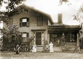
The Triangle neighborhood contains architecture that reflects the buildout period of the city’s history from the 1890s to the 1930s. One of the initial urbanites to move into the area was William J. Connors.
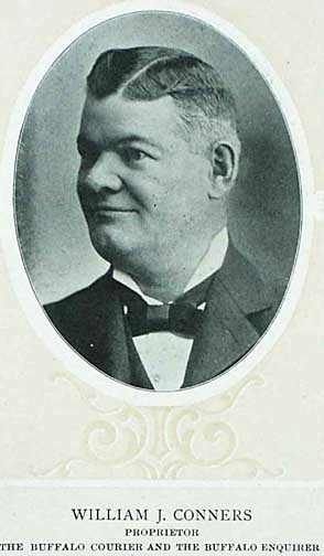
In 1890, Connors, the owner of a Buffalo newspaper and a powerful figure in city politics, erected an imposing brick and stone Queen Anne style residence together with a large carriage barn and a green house on property he purchased at the northwest corner of South Park Avenue (then called White’s Corners Road) and Tifft Street. (The Connors’ property is the present site of Holy Family Roman Catholic Church.) For many years, Connors’ house was the largest dwelling in South Buffalo. Dr. Frederick M. Boyle, a respected physician, lived nearby in another large Queen Anne style house at 1445 South Park Avenue. (This house had earlier been the residence of William H. Fitzpatrick, a man responsible for erecting many of the houses in the Triangle neighborhood.) A third early large dwelling, with stable, still stands at 1737 South Park Avenue. It was built in 1894 by F. C. Pries, whose presence in the area is remembered in the name of adjacent Pries Street. But large dwellings lived in by influential, well-to-do citizens were not to be common in the Triangle neighborhood. Rather, Olmsted’s reference to rise of factories and other industries near the district identified the driving force behind the formation of most of the residential streets in the area. Nearby industries, such as, the Lehigh Valley Railroad, Lackawanna Iron and Steel, National Aniline, and the Goodyear Intensive
Level Historic Resources Survey City of Buffalo:
Triangle Neighborhood Rubber Company brought many working class families to live on the land that had formerly been the reserve of the Seneca Indians. The Triangle neighborhood was one of those that developed as a typical “streetcar suburb” where most breadwinners worked in nearby industries. Its many new residential streets became lined with small, closely spaced single-family houses or two-story, double family flats. Able to travel to places of employment by streetcars (the first line in the Triangle neighborhood was in operation in 1897) running along Abbott Road, South Park Avenue, and Hopkins Street, and later by automobile (all homes erected on Crystal Avenue in the 1920s, for example, had garages), local residents, like thousands of their counterparts in other cities, could enjoy the pleasures of home life away from the immediate proximity of commerce and industry. Since the middle of the nineteenth century, Americans had been seeking out locations in the suburbs for domestic life. Olmsted and Vaux’s 1868 design for Riverside, Illinois, became a model that many later residential suburbs were to follow. In 1870, the same landscape architects had proposed that Buffalo lay out Parkside as a similar residential neighborhood adjacent to the new park system in North Buffalo. Like Riverside, Parkside’s streets were to be gently curving, tree lined and provided with pedestrian sidewalks.
Housing in the Triangle neighborhood and other streetcar suburbs provided, in the words of social historian Dolores Hayden, “a cut-rate version of the verdant residential ideal expressed in the picturesque enclaves” such as Parkside. Her generic description of such a locality aptly describes
Buffalo’s Triangle neighborhood:
Served by the . . . electric streetcar, these new buildouts began as linear real estate developments along the expanding transit lines. Sometimes they were adjacent to urban or suburban industries. Owners of large tracts of land subdivided and marketed lots to many second-generation Americans, children of immigrants who had grown up in inner-city tenements. Subdividers sometimes organized construction of houses, but more commonly small builders took over, or the owners built themselves. Houses were usually on a modest scale. They included single-family, two-family, and three-family dwellings, plus some commercial and apartment structures. The Development of the Triangle Neighborhood While some of the houses in the Triangle neighborhood belonged to owner-builders, most were put up on speculation by a number of private developers.
Some of these, such as the Metropolitan Mutual Savings and Loan (especially active here in 1899), H. B. Construction Company (especially active here in 1913-1914), Lodge Realty Corporation (especially active here in the 1920s), were city-wide corporations; others, such as Adolf Langendorfer (who lived in the neighborhood in a home he built in 1909 at 212 Southside Parkway ( and wasespecially active here c. 1915), Walter H. Nelson, George Schifferle, and William H. Fitzpatrick (the latter three were especially active here in the 1920s), were individual entrepreneurs. Of the group, Fitzpatrick, who had started building houses on Hopkins Street in 1897, was clearly the most important. An influential politician who together with W. J. Connors dominated Democratic party politics in the city, Fitzpatrick, said the Courier-Express at the time of his death in 1932, had “built hundreds of houses in South Buffalo and is credited generally with developing the section into a residential area.” In rough and tumble Buffalo politics of the 1920s, “Buy a home from ‘Fitz’ and get a job” was a phrase with which many were familiar. The types of dwellings that Fitzpatrick and other speculators erected were invariably free standing, of frame construction and similar in style and design. Such “repetitive building” was common to these new types of neighborhoods. “No special regulatory body was needed to tell most builders what was appropriate,” notes historian Sam Bass Warner, Jr., “the other houses Intensive Level Historic Resources Survey City of Buffalo: Triangle Neighborhood in the area presented them with models . . . . They were a conservative group and sought safety in their operations by restricting themselves to one or two house styles and catering to a limited price range of customer.” Nearly identical hipped-roofed bungalows at Crystal Avenue bear witness in the Triangle neighborhood to Warner’s observation. A few double houses depart from the general of clapboard or shingle siding. When John Jepson erected a house at 102 Macamley Street . in 1911, he chose to clad the wooden frame with red brick and to add white stone trim elements. Quoins boldly define corners and frame windows in an earnest bid to give a stand-out-from-the-crowd, monumental appearance to the standard gable fronted, two-story house type. Jepson erected a similar house the same year at 11 Remoleno Street. Also sporting stone quoins is the double house at 144 Macamley, which is one of the few solid brick houses in the neighborhood.
Neither individual nor speculative builders in the Triangle neighborhood employed architects to design their houses. Rather, like most developers in such “zones of emergence,” they used plans that could be purchased cheaply from various house plan companies. Some (especially individual owners) may also have built popular mail-order or “kit houses,” complete house units designed to be assembled on the buyer’s site. Architectural historian Daniel D. Reiff has identified more than seventy-five companies that between 1883 and 1951 sold house plans through the mail. Builders throughout the country relied on the good-looking plan catalogues from such Chicago companies as the Radford Architectural Company, Sears, Roebuck & Company, and the Chicago House Wrecking Company rather than on professional architects for designs, blue prints, and specifications for buildings they erected. “All this detailed information will [enable you to] . . . estimate almost to the dollar what the building when completed will cost,” read a typical claim in such literature.
Single family homes in the Triangle neighborhood are in a limited variety of styles. A number are based on the hipped-roofed Foursquare or Box House form that began to appear around the turn of the century in such sources as Shoppell’s Modern Houses (1900) and Radford’s Modern American Homes (1903). These houses with porches on the front were simple in form, economical to build, and ample in the accommodation they afforded. Furthermore, their squareish footprint fit nicely onto the long rectangular lot that was standard property type in the Triangle neighborhood. Good examples are at 80 Allegany Street, 202 Crystal Avenue, 142 Folger Street, and 192 Southside Parkway. This style of buildings also seemed to the people who bought them to be a modern version of the Georgian house of colonial America. This association was often reinforced by the presence of such ornamental details as columns and corner pilasters, as appear on the house at 192 Southside Parkway. . American Foursquare with Colonial Revival detailing at 192 Southside Parkway Built by C.P. Stevenson in 1895. Intensive Level Historic Resources Survey City of Buffalo: Triangle Neighborhood Most other single family homes in the Triangle neighborhood were modeled on the bungalow style. This style of domestic architecture was popularized by the writings of Gustave Stickley in such publications as The Craftsman magazine. Stickley emphasized simplicity in design and undisguised expression of material in construction. So-called Craftsman houses depended on such elements as solid piers, roof brackets and exposed rafter ends for architectural expression. Smaller single family dwellings in the Triangle neighborhood often take the form of what Reiff calls the gabled bungalow. Houses of this type are one-and-a-half stories, have gabled roofs, often with a side dormer, and are covered with shingles or clapboard, sometimes in combination.
The freestanding single-family Colonial Revival dwelling so popular in the 1920s in more affluent garden suburbs is generally absent from the Triangle neighborhood. A notable exception to this rule is the dwelling that stands at Heussy Street is splendidly preserved house is nearly identical to the gambrel-roofed “Dutch” Colonial design that Bennett Homes sold as a kit- house in its 1927 catalogue; surely the builder (William H. Fitzpatrick & Sons, the initial developers of Heussy Street) purchased the structure from this local house company. The majority of residences in the Triangle neighborhood are two-family flats (also commonly called double houses or simply “doubles”). Typically, these rectangular, two-story with-attic frame dwellings contained distinct apartments on each floor. Invariably oriented with the short side toward the street, they are covered with clapboard siding or wooden shingles. They usually have a simple gable roof or, less often, a hipped roof with a front dormer. A porch (often enclosed) extends across the front of the ground floor, and its roof serves as the floor for a porch for the upper apartment. Entrances are provided on both the street front and driveway side. Stylistic elements on these plain but substantial buildings are sparse and generally confined to such details as porch columns or eave brackets. Residences of this type drew the attention of the Courier in 1902 when it informed its readers that many of them were to be found in the new neighborhoods around South Park. “They are all sixteen-room houses,” stated the reporter, “nicely decorated, eight rooms to each flat, two stories high and contain all modern improvements, including gas, water, cellar, mantles and granolithic walks.” A dwelling like this—of the many in the neighborhood, 28 Alamo Street, 119 Folger Street 147 Good Avenue, are well preserved examples–brought home ownership within the means of working class families who would typically rent the upper flat to boarders in order to cover mortgage payments. Now factory workers, noted the Courier, “are becoming real estate holders in what is regarded as the most likely section of the city for real estate investment.
The influx of residents into the Triangle neighborhood and South Buffalo, generally, spurred the development of commercial structures, churches, and public buildings. The Triangle neighborhood retains a number of examples of such building types, although some are now used for purposes other than that for which they were designed.
Most commercial buildings are found along South Park Avenue, the primary neighborhood thoroughfare. Generally two stories high, these are pedestrian oriented with ground level shops entered directly from the street. The floor above the street would have apartments or offices. The brick building at 83-87 Abbott Road is a well-preserved representative of the type. With a stringcourse defining the floor levels, a projecting cornice, and stone keystones in the flat- arched second story windows, the structures displays the modest pretensions to Classical styling common the many such buildings of the period. The single-story block of stores and offices at 36 Abbott Road is another example of the use of Classical detailing to give a dignified character to neighborhood enterprises. Trimmed with pilasters, cornice and pediment, this sadly neglected building once housed the office of William H. Fitzpatrick, the now-forgotten caesar of South Buffalo Democratic politics and the initial developer of adjacent Heussy Avenue.
Mercy Hospital, the first hospital in South Buffalo, originally met health care needs of the many new residents in the Triangle neighborhood. In 1904, the Sisters of Mercy purchased the former William J. Connors home at the northwest corner of Tifft Street and South Park Avenue. (Prior to that time, the house had served as the rectory of Holy Family Church.) Moved a new site nearby on Tifft Street, Connors’ commodious house became the first Mercy Hospital. Transforming the former conservatory into the operating room and fitting out the first floor parlors as offices, pharmacy, and three private rooms, the Sisters of Mercy equipped the facility with beds to care for fifty patients. The adaptively reused building, however, was demolished in the late 1920s when the institution erected a much larger structure on Ridge Road, outside of the Triangle neighborhood. After the nuns sold the property with 200 feet of frontage on Tifft Street, the present frame dwellings were erected there. Several Christian denominations also established themselves in the Triangle neighborhood around the turn of the twentieth century. Most of the existing church buildings in the district date from this time, and all were designed by local architectural firms. The earliest religious group to erect a church was St. Jude’s Episcopal Church. In 1896, the congregation purchased a site at the northeast corner of Macamley and Dash Streets and constructed a small frame chapel that the local bishop dedicated in the summer of 1896. The congregation grew in size and in 1922 parishioners undertook to erect a new church on the site of the original chapel. After working with one architect, the congregation turned to the well-known Buffalo firm of North & Shelgren. (Robert North was the architect to the Episcopal dioceses of Western New York.) They designed a stone church in an updated version of the Early English Gothic parish church style 124 Macamley Street that nineteenth-century Episcopal churchmen had pronounced the best model for modern-day worship. The asymmetrical, random ashlar building, which has a parish building attached at the rear and an entrance tower nicely punctuating the street intersection, was finished, except for the spire (which is still lacking), in 1932.
Intensive Level Historic Resources Survey City of Buffalo:
Triangle Neighborhood
St. Jude’s Episcopal Church (1928-1931) at 124 Macamley Street
Designed by North & Shelgren, architects
In 1900, German Evangelical Reformed Church employed Buffalo architect Jacob Oberkircher to erect the present St. John’s Evangelical Reformed Church at 14 Good Street. Unfortunately altered from its original appearance, the simple symmetrical structure with small entrance tower is still in use by successors to the original German-American congregation. (Plans for a larger church to be built next to the chapel were never carried out.) The roots of the present South Park Baptist Church go back to 1887 when the Buffalo Baptist Union started a Sunday school in the area. After worshipping for nearly three decades in a building that the group had purchased in 1891 at the corner of Good and Triangle Street (the present South Park Avenue), the congregation purchased property at 187 South Side Parkway and erected the present church complex that North, Shelgren & Swift designed in 1925 . The red brick Georgian Revival building reflects the renewed interest that traditional architects were taking at the time in America’s colonial architecture due to the well-publicized restoration of Williamsburg, Virginia. (Indeed, the spire of the South Park Baptist Church tower recalls that of the famous Bruton Parish Church in Williamsburg.) And surely by intent, the architects arranged their grouping of church, tower, and parish hall to effectively terminate the eastward vista down Koester Street, which ends in front of the church. South Park Baptist Church (1925) at 187 South Side Parkway Designed by North, Shelgren & Swift, architects
The largest house of worship in the Triangle neighborhood is Holy Family Roman Catholic Church, located at the northwest corner of South Park Avenue and Tifft Street.
Built to serve the many Irish-American and German-American Catholics who had moved into the area, the imposing twin-towered Romanesque style stone edifice followed designs by Buffalo’s Lansing & Beierl. It was constructed (together with the picturesque rectory) between 1905 and 1908. Before that time, the congregation had worshiped in the carriage barn and home of William J. Connors, which the church purchased in 1902. Together with South Park High School, the church is the most significant piece of historic architecture in the Triangle neighborhood. The last church to go up in the Triangle neighborhood was St. Agatha’s (formerly All Souls) Roman Catholic Church at southwest corner of Abbott Road and Good Street. Although the congregation, which was composed mostly of Italian-American families, dates to 1909, the present church and school building, designed by Mortimer J. Murphy, were not erected until 1954.
Holy Family Roman Catholic Church (1905-1908) at 1887 South Park Avenue
Designed by Lansing & Beierl, architects
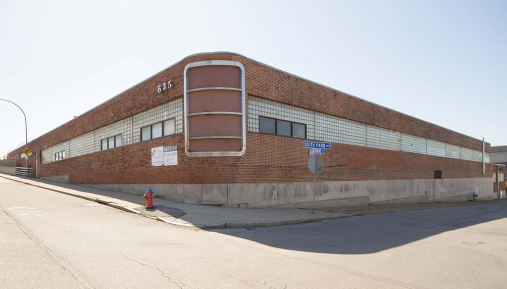
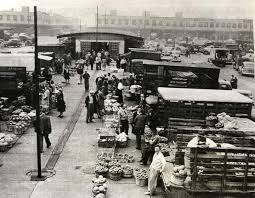
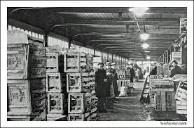
Public buildings were also erected around the turn of the twentieth century in the Triangle neighborhood to serve the growing number of residents. The largest of these was the South Buffalo Market, which was constructed by the city in 1926 on the east side of Bailey Avenue, north of Abbott Road. Today, the sprawling one-story, plain brick structure, to which additions have been made in a different type of brick, is used by the Board of Education as a transportation facility. In 1907, the city erected a firehouse for Hook & Ladder No. 10 at 731 Southside Parkway. The pale-toned brick structure, designed by Buffalo city architect Howard L. Beck, is reminiscent of old Dutch town houses and seems right at home in this residential neighborhood. Its cheerful face is a pleasant addition to the streetscape and a reminder of the days when even modest civic buildings were designed with taste. Closed in 1982, it enjoys renewed life as a small apartment building. The first public grade school to go up in the Triangle neighborhood was built on the site of a former duck pond at the corner of Triangle Street and Abbott Road. The present Public School No. 28 is the modern-day successor at the site to the original one-and-a half-story, brick and stone Colonial Revival style structure. Public grade school education was supplemented by two area parochial schools. In 1915, Holy Family Church erected on land behind the church on Tifft Street a flat-roofed, yellow brick school building designed by Max G. Beierl in a simple Neo- Intensive Level Historic Resources Survey City of Buffalo: Triangle Neighborhood Classical style; nine years later George J. Dietel designed a similar building adjacent to it. Both of these buildings continue to function as schools, as does the grade school that St. Agatha’s church opened in its new parish building 1954. The largest school building in the Triangle neighborhood is South Park High School, which occupies a spacious site on South Park Avenue bordered by Macamley, Taylor, and Josie Streets. Designed by the prominent local architectural firm of Green and Wicks, the yellow brick and sandstone building is one of the leading of the Neo-Classical style in Buffalo.
The grandest commercial structure in the district is the building designed in 1919 by Henry L. Spann as the South Park Theatre . The steel frame structure with red brick walls at 1770 South Park Avenue was once the principle locale for vaudeville and motion picture entertainment for residents of the Triangle neighborhood. Now owned by the American Legion Post 64, it retains a significant amount of its exterior terra cotta Classical ornament as well as the original proscenium arch and other interior features. Occupying a major neighborhood intersection, it yet manages, despite alterations, to convey a festive appearance. Well cared for by the present owners, the theater survives as a poignant reminder of the days when the Triangle neighborhood began its life as a vibrant streetcar suburb. In those early days, many groups had a stake in the growth and development of the Triangle neighborhood and South Buffalo. Giving coherent voice to the aspirations of home owners, speculative builders, religious organizations and businessmen, were civic organizations. Chief among these early groups was the South Buffalo Citizens’ Association.
“No better example of what an intelligent, enthusiastic, broad-minded body of citizens can accomplish to build up a community could be asked than a report of the activities” of that group, said Heacock’s magazine of the Association that formed in 1921. Among its successful campaigns that directly affected the Triangle neighborhood were the improvement of Bailey Avenue, the installation of street lamps on many streets, and the creation of the new South Buffalo Market.
The Association also endeavored to promote the image of the area, which many Buffalonians regarded as an urban wasteland. “I wish every resident of the section would make it his business to urge his friends in other parts of the city to come and look over the neighborhood,” remarked Frank Schreck, the association treasurer. By the mid-1920s, this quarter of the city had improved so much that, as Schreck asserted, it “would certainly be a surprise to the rest of Buffalo, particularly those people who are used to thinking of South Buffalo as a region entirely given over to frogs and factories.”
—————————————————————————————————————————————————————-
*
*
*
*
*
*
*
*
*
*
*
*
*
This overview could not have been written without the research carried out by Christine Longiaru, Martin
Wachadlo, and Thomas Yots.
See the Buffalo Grain Elevator National Register Multiple Property Documentation Form for more
information about this aspect of the city’s history.
H. W. Hill, Municipality of Buffalo: A History, 1720-1923 (New York: Lewis Historical Publishing Co.,
1923). It is probable that the Senecas chose to settle in the area because some of their number
had knowledge of it prior to 1780. William Ketchum, An Authentic and Comprehensive History of Buffalo (Buffalo: By the author, 1865),
Index to Records of Streets, Public Grounds, Waterways, Railroads, Gas Companies, Water Works,
etc., of the City of Buffalo, from 1814 to 1896 (Buffalo: bureau of Engineering, 1896), pp. 5-6.
Mark Goldman. High Hopes: The Rise and Decline of Buffalo, New York (Albany: SUNY Press, 1983),
“Journals of Henry A. S. Dearborn,” Publications of the Buffalo Historical Society, VII(1904),
8Index, 501, and Proceedings of the Common Council of the City of Buffalo, 1854, p. 25. The land was
still known as the Indian Reservation.
Goldman, This road, the present South Park Avenue, was first surveyed from the Hamburg line to Abbott’s
Corners Road (the present Abbott Road) in 1845. In 1849, it was granted to the Plank Road Company
and in 1850 it was recorded as a public road. See Index,
Buffalo Morning Express, extra number, September, 1888, rear cover.
“Common Council,” Buffalo Morning Express, March 1, 1887,
Frederick Law Olmsted and John C. Olmsted The Projects Park and Parkways on the South Side of
Buffalo (Buffalo: City of Buffalo, Park Commission, 1888), in S. B. Sutton (ed.), Civilizing American Cities:
A Selection of Frederick Law Olmsted’s Writings on City Landscape, Cambridge, MA: The MIT Press,
1979 See David Schuyler, “Cityscape and Parkscape,” in F. Kowsky (ed.), The Best Planned City: The
Olmsted Legacy in Buffalo (Buffalo: Burchfield Art Center, 1992). Intensive Level Historic Resources Survey City of Buffalo: Triangle Neighborhood
Frederick Law Olmsted thought that the new parkways would be mostly for the enjoyment
of southside residents, for he envisioned that most people traveling from other parts of town would reach
the new park by streetcar, railroad, or even by boat. This suggestion is probably the genesis of the later Southside Parkway (the present McKinley
Parkway). This suggestion is probably the genesis of the future Red Jacket Parkway and Cazenovia Park.
See the Buffalo Park and Parkway System National Register nomination. 26 Charles Beveridge, “Frederick Law Olmsted’s Vision for Buffalo,” in F. Kowsky (ed.), The Best Planned
City: The Olmsted Legacy in Buffalo, Buffalo: Burchfield Art Center, 1992,
“The Rebirth of South Park,” Heacock’s, X(September 1924)
Shortly after this work was completed, the South Buffalo Market went up on the new section of Bailey
Avenue, as did most of the houses behind the market on Heussy Street.
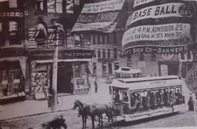
The Crosstown Street Railway initiated service in the Triangle neighborhood in 1897 on Abbott Road
from Triangle Street to Cazenovia Street. In 1902, the company extended service from the neighborhood
into downtown via South Park Avenue, Triangle Street, Abbott Road (both of these streets are now called
South Park Avenue) and Elk Street. The line was part of sixteen miles of new track laid in South Buffalo
in 1916. See William R. Gordon, 90 Years of Buffalo Railway (Buffalo, by the author, 1970), p. 73.
31 Dolores Hayden, Building Suburbia, Green Fields and Urban Growth, 1820-2000 (New York: Pantheon
Books, 2003), p. 71. For Parkside, see the National Register for Historic Places historic district
nomination.
33 “Fitzpatrick’s Body Arrives from New York,” (Buffalo) Courier-Express, January 8, 1932, p. 8. By the
time of his death, Fitzpatrick had brought his sons into the business, which was known as W. H.
Fitzpatrick & Sons. 34 “William H. Fitzpatrick Still ‘Trying to Get Out of Politics,’” (Buffalo) Times, January 2, 1931.
35 Sam Bass Warner, Jr., Streetcar Suburbs: The Progress of Growth in Boston, 1870-1900 (Cambridge,
MA: Harvard University Press, 1978), p. 76.
36 Daniel D. Reiff, Houses from Books, Treatises, Pattern Books, and Catalogs in American Architecture,
1733-1950: A History and Guide (University Park: The Pennsylvania State University Press, 2000), p.
185.
37 These houses are discussed and illustrated in Robert Schweitzer and Michael W. R. Davis, America’s
Favorite Home: Mail-Order Catalogues as a Guide to Popular Early 20th-Century Houses (Detroit: Wayne
State University Press, 1990), pp. 161-168. 38 For an illustration of the Bennett Homes house, see Reiff, p. 282.
39 See Reiff, p. 289, Fig. 616. 40 See Reiff, p. 287. 41 See Reiff, p. 294, Fig. 662, for an illustration of the Bennett Homes house.
42 “New Modern Residences in the Steel Plant District,” Buffalo Courier, August 10, 1902.
43 See “Mercy Hospital Will Open Soon,” Buffalo Express, July 28, 1904, and “South Side’s New
Hospital,” Buffalo Courier, August 14, 1904.
44 Information on the churches of the Triangle neighborhood is drawn from James Naporal, “Houses of
Worship: A Guide to the Religious Architecture of Buffalo, New York” (unpublished Masters thesis, School
of Architecture, University at Buffalo, 1995). 45 See Proceedings, 1923, pp. 465-466; 1923, p. 2681; and 1926, p. 164.
46 For a description and illustration of the original P.S. No. 28, see “Out in the Street,” Buffalo Courier,
May 4, 1894. The school is included in an earlier survey. “South Park Citizens Unite for Progress,” Heacock’s, X (September 1924),